Satellites expose mysteries of the deep ocean
New global seafloor map is most accurate ever created
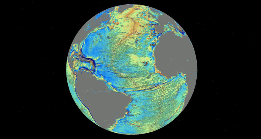
SUNKEN SURFACE A new map charts the depths of Earth’s oceans (Atlantic shown) in unprecedented detail using satellite data. Warm colors correspond to formations such as mountains and continental shelves; bluer colors represent deeper areas such as trenches.
Google Earth, overlay by D.T. Sandwell/Scripps Institution of Oceanography